Master the field.
GIS, 3D maps, data logging...

GIS, 3D maps, data logging...


Notas modulares con texto, tablas e imágenes. Captura ideas con notas rápidas y exporta informes a PDF.
Modular notes with text, tables and images. Capture quick ideas and export full PDF reports.

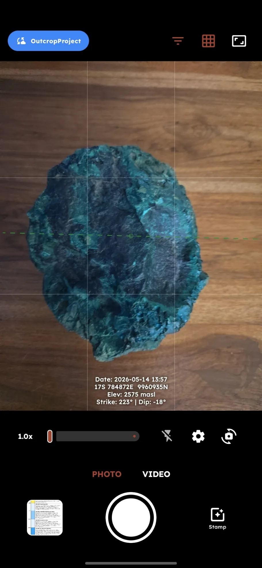
Fotos y videos con UTM, elevación, fecha y rumbo grabados directamente en la imagen.
Photos and videos with UTM, elevation, date and bearing printed directly on the image.
Visualiza y organiza tus fotografías de campo. Extrae coordenadas GPS de cada foto.
View and organize your field photographs. Extract GPS coordinates from each photo.

Convierte coordenadas (UTM, Decimal, DMS) y más de 40 unidades físicas al instante.
Convert coordinates (UTM, Decimal, DMS) and over 40 physical units instantly.

Registros por intervalos con categorías y paletas de colores. Ideal para striplogs, columnas litológicas y sondeos.
Interval logs with categories and color palettes. Ideal for striplogs, lithologic columns and borehole records.

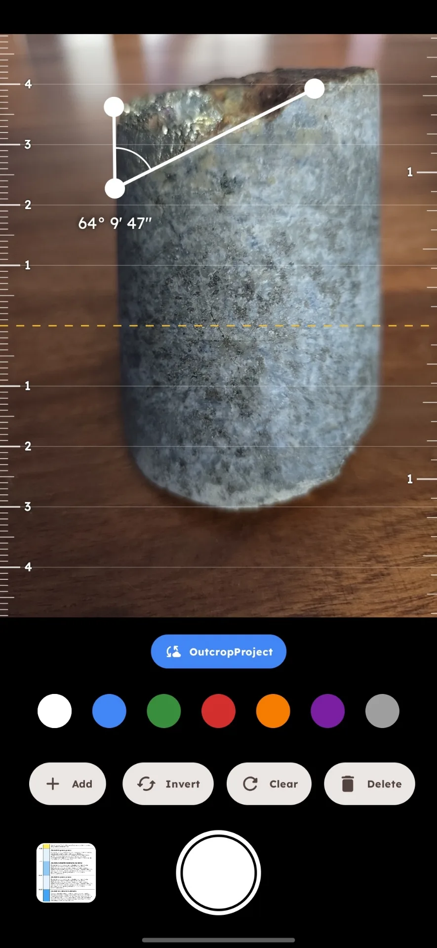
Mide ángulos con realidad aumentada ajustando vértices sobre elementos físicos.
Measure angles in augmented reality by adjusting vertices over physical elements.
Mide Azimut, Dirección de Buzamiento y Rumbo/Buzamiento con un toque usando los sensores del dispositivo.
Measure Azimuth, Dip Direction and Strike/Dip with one tap using the device sensors.

Proyecciones Wulff, Schmidt, contornos de densidad y rosas. Exporta reportes estructurales a PDF.
Wulff, Schmidt, density contour and rosette projections. Export structural reports to PDF.


Disponible ahora
Android · Google Play
Próximamente en iOS
Estamos puliendo los últimos detalles para llevar la mejor experiencia de mapeo geológico a tus dispositivos Apple.
Available now
Android · Google Play
Coming soon to iOS
We are polishing the final details to bring the best geological mapping experience to your Apple devices.